


Don’t leave yourself in Deep Water!
SUMO’s engineering geophysics team can provide invaluable information during the construction and management of water infrastructure.
Whether remedial work is taking place to replace harbour gates, restoration work is being done to re-open a disused canal, or settlement or cracks are appearing along promenade, SUMO’s engineering solutions can help identify the problem.
Harbours and promenades
GPR can be used to search for evidence of hidden voids within harbour walls, which are often caused by the gradual washing out of fines or discrete changes in material composition. Investigations can be carried out from the top of the harbour walls, using surface GPR profiles and on the side of the walls using vertical GPR profiles.

Above - A GPR survey in progress over the top and side of a harbour wall.

Above - A vertical GPR profile down the side of a harbour wall, showing evidence of voiding at 0.7-1.2m within the wall..
Canals
GPR surveys are also particularly useful for locating voids hidden beneath a towpath or behind a lock chamber. Again, GPR profiles can be surveyed along the towpath to produce sections behind the lock wall, while the internal structure of a lock wall can be investigated using vertical profiles down the face of the wall. Results can then be used to determine the wall profile and thickness and to locate internal defects.

Above - Interpretation drawing of a GPR survey showing voiding (areas of blue) and other defects behind a canal wall.
Locks & Weirs
Often there is a need to consider the wider area whilst working on a particular water asset. For example, during remedial operations on locks and weirs, such as a gate replacement, a GPR survey may be necessary over the proposed track and station of the crane to check for areas of voiding before siting the crane.

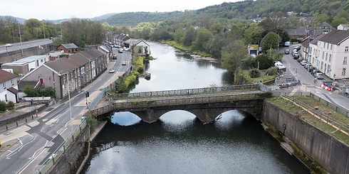
Bridges
UAS (drone) survey can also be used in difficult to reach or dangerous areas. In the example below an urgently needed replacement bridge had to be built on the same site as the collapsed bridge. However, prior to its imminent demolition, a detailed survey was required of the surviving structure which was in a hazardous and difficult position and deemed unsafe for access on foot.

Accordingly, a detailed UAS survey was undertaken, and the structural engineers were then able to design the replacement bridge including elements of the old structure, without delaying its demolition.
A 3D model of the data also enabled a varied audience to visualise how the site would look, after restoration.
With a vast wealth of experience and a wide range of equipment applicable to many different scenarios, SUMO are here to help you to understand your water infrastructure, avoid any hidden dangers on your site and minimise unexpected costs.
-
How accurate is SUMO's underground utility survey and what types of utilities can it locate?Using cutting-edge technologies like electro-magnetics, signal induced threading, and Ground-Penetrating Radar (GPR), our underground utility surveys accurately detect a wide array of buried utilities including metal and plastic pipes, drainage systems, electricity cables, telecoms, and fiber optic cables. The methodology ensures high accuracy without the need for invasive trial holes.
-
What is the turnaround time for obtaining results with SUMO's Underground Utility Detection service?SUMO’s service is built for rapid response. Contractors can receive immediate results onsite. Our equipment provides real-time information, and once we leave the site, the detected utilities are visibly marked on the ground surface for quick reference.
-
Does SUMO provide detailed mapping of the detected utilities for permanent records or construction purposes?Absolutely, SUMO not only marks the detected utilities on-site but also offers high-quality, color-coded survey drawings. These drawings can include topographic features and a comprehensive record of the utility detection survey, ensuring it meets the client’s needs for future reference or pre-construction design works.
-
Topographical and Geophysical surveyIn addition to mapping out utilities, our experience team can accurately survey the land, creating topographical drawings for use. With our state-of-the-art aerial technology, nothing is missed.
-
What additional information can be included in the underground utility mapping service provided by SUMO?In addition to topographic features, SUMO’s mapping service can include fixed surface utility features such as inspection chambers, valve boxes, and telegraph poles. It can also incorporate key topographic details like building lines, fence lines, kerb lines, street furniture, street names, building names, and house numbers, facilitating easy site location.
-
Does the utility mapping service by SUMO include standard referencing and compatibility with existing survey data?Yes, SUMO ensures the utility mapping references the ordnance survey grid and level datum as standard. Additionally, the drawings can be supplied to a specified grid and level datum and can overlay an existing topographical survey, making it a versatile and adaptable service for various project needs.
-
What sets SUMO Services apart from other survey providers?SUMO stands out due to our impeccable level of service with nationwide coverage, state-of-the-art equipment, and our commitment to delivering top-quality, detailed colour-coded survey drawings in both hard and electronic formats.
-
How do I request a survey quotation from SUMO Services?Requesting a quotation is easy. Just click on the "Request a Survey Quotation" button on this page, and our team will get in touch with you promptly.
-
Can I book a SUMO Survey online?Yes, you can! Simply click on the "Book a SUMO Survey" button on this page, and you can schedule your survey with us at your convenience.
-
What type of survey is suitable for my project or site?Our experienced team will work with you to determine the most appropriate survey for your specific needs. Contact us, and we'll assist you in making the right choice.
-
Can I obtain both digital and hard copies of survey drawings?Absolutely. We offer the convenience of electronic copies for digital use and hard copies for your records. Just let us know your preference.
-
Do you provide custom survey solutions for unique projects?Yes, we understand that every project is unique. Our team is highly adaptable and can tailor our surveying services to meet your specific requirements.
-
How do I get in touch with SUMO Services for further questions?For any additional questions or inquiries, feel free to contact us through the contact form, and our dedicated team will assist you promptly.


Geophysical Engineering Surveys

Air Raid Shelters

Cellars & Basements

Mineshafts

Tree Roots

Air Voids

Chimney Flues

Post Tension Cables

Underground Storage Tanks

Badger Setts

Earthing Installations

Rebar

Water Engineering

Burials

Geological Application

Sinkholes

Buried Foundations

Landfills

Soil Thermal Resistivity Testing

Buried Manholes

Microgravity
