


The Benefits of Using a Drone for Surveying: An In-Depth Guide
- Claire Rose
- Apr 2
- 6 min read
Drone Technology in Surveying
In the rapidly evolving field of surveying, drones – also known as UAS (Unmanned Aircraft Systems) – have emerged as a revolutionary tool. Drones offer a blend of speed, precision, and efficiency that traditional methods struggle to match. At SUMO Services, we harness the power of drone technology to provide our clients with highly accurate and timely data, transforming the way projects are planned and executed.
Drone surveying has become an essential part of various industries, including construction, environmental monitoring, and land development. The drone captures detailed aerial data across large areas, allowing surveyors to gather information quickly and accurately. In this article, we’ll explore how drone surveys work, their applications in the field, and the key benefits they offer.
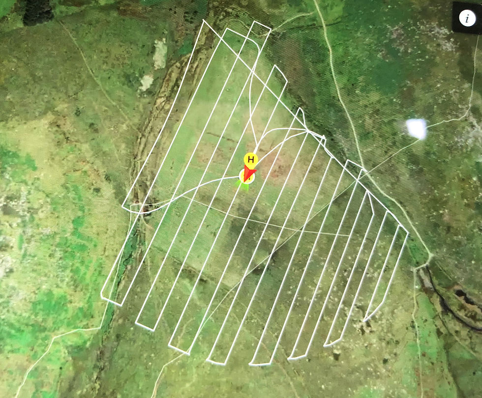
How Does a Drone Survey Work?
Drone surveying, or UAS land surveying, involves using drones equipped with cameras and sensors to collect aerial data over a designated area. Here’s a step-by-step breakdown of the process:
Flight Planning for UAS Drone Surveys:
At SUMO Services, we meticulously plan the drone’s flight path to ensure comprehensive coverage of the site, considering terrain, weather, and other site-specific factors.
Data Collection in Drone Topographic Surveys:
During the flight, the drone captures high-resolution images or other sensor data. This can include RGB photographs, multispectral images, thermal scans, or even LIDAR data, depending on the project’s needs.
Processing Data from Aerial Mapping Surveys:
The collected data is processed using photogrammetry software to generate detailed 2D maps, Digital Elevation Models (DEMs), point clouds, 3D models, and other outputs essential for accurate analysis.
Integration with Other Systems in UAS Survey Projects:
Finally, our surveyors analyse the processed data, extracting insights for planning, design, or monitoring, and integrate this data with existing systems to ensure smooth project workflows.
How Are Drones Used in Surveying?
Drones are versatile tools used across various surveying applications, each offering distinct advantages. Here’s how we employ drones in our surveying projects at SUMO Services:
Drone Land Surveying for Topographic Maps: We create accurate topographic maps essential for construction and civil engineering projects. Our data can be combined with terrestrial mapping for enhanced accuracy, and can serve as a basis for topographic drawings.
Aerial Mapping Surveys Using Survey Drones: Drones allow us to map extensive areas quickly, providing vital data for industries like agriculture and forestry.
Drone Construction Surveys for Site Monitoring: We use drones to monitor construction progress, inspect structures, and provide real-time site updates.
Drone Geological Survey Applications: Drones enable us to map and analyse geological features, even in challenging or remote areas.
Drone Photogrammetry Surveying for 3D Models: Drones help us generate detailed 3D models and maps for precise measurements and analysis.
Drone Point Cloud Reconstructions: Drones can produce point cloud data using photogrammetry and LiDAR for building recording and topographic surveys. Point cloud data can be combined with Laser Scan data for complete building modelling.
These applications demonstrate the wide-ranging utility of drones in surveying, enabling us to deliver accurate, reliable data for various needs.

What Are the Benefits of Drone Surveying?
Increased Accuracy and Precision in UAS Surveying
How Drones Enhance Measurement Accuracy in Aerial Surveys
Drones equipped with GPS and high-resolution cameras capture data with high accuracy. At SUMO Services, we prioritise accuracy, ensuring that every project benefits from the highest quality data. This accuracy is crucial in construction and environmental assessments, where even small errors can lead to significant consequences. Ground control targets are deployed for accurate levels across a site. This data can be further enhanced by combining the outputs with a terrestrial topographic survey.
Precision in Data Collection with Drones for Photogrammetry
Our drone surveys are carried out methodically and are processed to a high standard to ensure that our outputs are both accurate and precise. This precision ensures that no detail is overlooked, leading to better-informed decisions and more successful project outcomes.
Cost Efficiency in UAS Land Surveying Operations
Reducing Traditional Survey Costs with Drones for Surveying
Drone surveying can dramatically cut costs associated with traditional methods. By reducing the need for extensive manpower and equipment, drones make it possible to complete surveys quickly and cost-effectively. This efficiency translates to direct savings for our clients.
Cost-Benefit Analysis of Drone Use vs. Traditional Methods in Aerial Photography Surveying
When compared to traditional surveying methods, drones offer a significant cost advantage. The initial investment in drone technology is quickly recouped through savings in labour, equipment, and time, making drones a financially sound choice for projects of all sizes, without compromising on deliverables.
Improved Safety for Survey Teams with Drone Survey Services
Minimising Risks in Hazardous Areas with Drone Surveys
Safety is paramount at SUMO Services. Drones allow us to conduct surveys in hazardous or difficult-to-reach areas without putting our team at risk. Whether it's surveying a cliff face or inspecting an unstable structure, drones can collect the necessary data while keeping surveyors safely on the ground.
Safety Advantages Over Conventional Surveying Methods with Drones for Site Survey
By reducing the need for surveyors to physically enter dangerous environments, drones help minimise the risks associated with traditional surveying methods. This not only enhances safety but also speeds up the survey process as fewer safety precautions are required.
Accessibility and Reach with Drones for Mapping and Surveying
Accessing Difficult Terrain and Remote Locations with Survey Drones
Drones excel at reaching areas that are challenging or impossible for humans to access. At SUMO Services, we use drones to survey dense forests, mountainous regions, and other remote locations, ensuring comprehensive data collection regardless of the terrain.
Expanding the Scope of Surveyable Areas with Drones for Land Surveying
Drones enable us to cover larger areas in a shorter time frame, expanding the scope of what can be surveyed. This capability is especially beneficial for large-scale projects, such as land development or infrastructure planning, where traditional methods might be impractical or too time-consuming.
Time Efficiency and Project Speed in Drone Surveying for Construction
Faster Data Collection and Processing with Drone Inspection Services
Drones significantly accelerate the data collection process. What might take days or weeks using traditional methods can often be completed in hours with a drone. This efficiency is crucial for keeping projects on schedule and ensuring timely delivery of results.
Impact on Project Timelines and Delivery with Drone Survey Services
The speed of drone surveys directly impacts project timelines, allowing for quicker decision-making and faster project completion. This advantage is particularly valuable in industries where time is of the essence, such as construction and land development.
6. Enhanced Data Quality and Output in Drone Photogrammetry Surveying
Variety and Volume of Data Captured by Drones for Topographic Survey
Drones capture a wide range of data types, from high-resolution images to thermal and multispectral data. This diversity of data provides a more comprehensive view of the survey area, enabling better analysis and decision-making. At SUMO Services, we use this data to deliver high-quality outputs that meet the specific needs of each project.
Integrating Drone Data with GIS and Other Systems in UAS Survey Projects
The data collected by drones can be easily integrated with GIS and other mapping software, enhancing the overall quality and utility of the survey results. This integration allows for detailed mapping, spatial analysis, and efficient management of survey data.
7. Environmental Monitoring and Management with Drone Geological Surveys
Using Drones for Environmental Assessment in UAS Land Surveying
Drones are increasingly used for environmental monitoring, providing detailed data on ecosystems, vegetation, and wildlife. This data is essential for assessing environmental impact, monitoring changes over time, and supporting conservation efforts. Drones offer a non-invasive way to gather this data, reducing the impact on the environment.
Contributions to Sustainable Practices through Drone Surveying
Drones contribute to sustainable surveying practices by minimising the need for heavy equipment and reducing the environmental footprint of survey operations. This aligns with the growing emphasis on sustainability in various industries, making drones an eco-friendly option for data collection.
Key Takeaways
Drone surveying offers numerous benefits that make it a superior choice compared to traditional methods. From time-saving and cost efficiency to improved safety and high data quality, drones have transformed the surveying landscape. Their ability to access difficult terrain, quickly gather data, and integrate seamlessly with existing systems makes them an invaluable tool for surveyors.
FAQ
What makes drones advantageous for surveying tasks?
Drones can access difficult terrains, reduce risks, and offer significant cost and time savings compared to traditional survey methods, while maintaining high accuracy.
How do drones improve the accuracy of surveys?
Drones can fly close to the ground and use advanced sensors to collect high-resolution images and data, which leads to more accurate and precise measurements. Critically, they can access areas which may not be possible on foot, to help fill in areas where traditional methods can’t reach. Drones used in conjunction with terrestrial topographic and MBS surveys create a highly accurate and thorough dataset.
Are there any cost benefits to using drones in surveying?
Yes, drones reduce labour and equipment costs, decrease the time needed for data collection, and minimise the expenses associated with accessing remote or difficult locations.
What safety benefits do drones offer in surveying?
Drones eliminate the need for human presence in hazardous or inaccessible areas, reducing the risk of accidents and ensuring safer survey operations.
How do drones affect the efficiency of surveying projects?
Drones significantly speed up the data collection process, allowing for quicker project turnaround and more efficient handling of large-scale surveys.
Can drones be used for environmental monitoring?
Yes, drones are effectively used for environmental monitoring, providing detailed data on vegetation, wildlife, and changes in the landscape without disturbing the area.
Interested in capturing an aerial view of your property?
If you’re ready to experience the benefits of drone surveying for your projects and receive a quote, you can contact us on 0845 456 1104 or you can reach out to our team online here.